- 16. April 2024, 21:49

 Overcast
-3°C4 m/sApparent: -9°CPressure: 1017 mbHumidity: 85%Winds: 4 m/s SWindgusts: 14.1 m/sSunrise: 06:12Sunset: 22:55
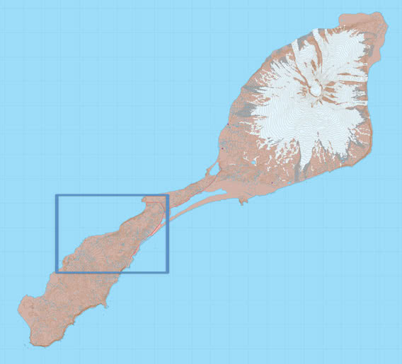
Sør Jan Inland
These photo galleries show images from the inland of the southern part of Jan Mayen (Sør Jan) between Kvalrossbukta, Olonkinbyen (the station) and west of it, towards Sjuhollendarbukta. For station members who like a good hike, this is almost their backyard. For anyone else, this area is quite inaccessible, especially the part south of Karl Stephantoppen. The area between Kvalrossbukta and Karl Stephantoppen is well in reach for a rather easy day trip, when the weather is good. It fits well into the programm of a stay of 6 days our so, when you mostly focus on Nord Jan (northern Jan Mayen), as most people will do.
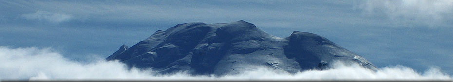
The view from the ridge south of Kvalrossbukta (Antarcticberget, Slettfjellet, Holtanna) can be great, you are looking down on Kvalrossbukta and Haugenstranda and over Mid Jan to Beerenberg and Eggøya. Unfortunately, the visibility is often hidden by low clouds, especially in summer. The first images are from the area near the little crater Holtanna („hollow tooth“), then we continue to Karl Stephantoppen. Being 551 m high, Karl Stephantoppen is a crater which is easily climbed, offering a great panorama view. There is a little lake in the crater, which is open to the northeast.
Detail:
Sør Jan Inland
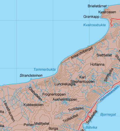
Extensive area of deep, soft mosses make going quite hard. In fog, you will easily lose orientation, GPS and map and compass are essential. The map does not reveal all the important terrain details, though. There is a lot of up and down the hills, you will quickly do a lot of altitude even though you don’t get very high up.
The photo of Lunckekjegla as seen from Karl Stephantoppen is currently one of my favourite Jan Mayen images: the warm sun makes the damp mosses steam. On the slope you can see patterns of ice wedges, probably dating back into the ice age as permafrost is required for the formation of ice wedges.
In the other direction, towards the south coast, we see the high antennas near the station and, to the right, the rugged ridge of Schiertzegga.
Photo gallery Sør Jan Inland – 1
Click on thumbnail to open an enlarged version of the specific photo.


The riverbed in upper Trolldalen is completely dry, water disappears quickly into the poriferous lava rocks. Lack of water is something you need to take into consideration while hiking on Jan Mayen. Mostly, you have to rely on snow fields.
There is a path between the station and Sjuhollendarbukta, well-trodden over time and over large parts even marked with metal poles and netballs. Station members are often walking there in their free time.
The lava fields with their extensive areas of sharp-edged rocks are by nature difficult walking terrain, but not impassable. You can find small lava caves every here and there.
Photo gallery Sør Jan Inland – 2
Click on thumbnail to open an enlarged version of the specific photo.


last modification: 2021-08-01
copyright: Rolf Stange
copyright: Rolf Stange
 · jan-mayen.com – CO2-neutral